
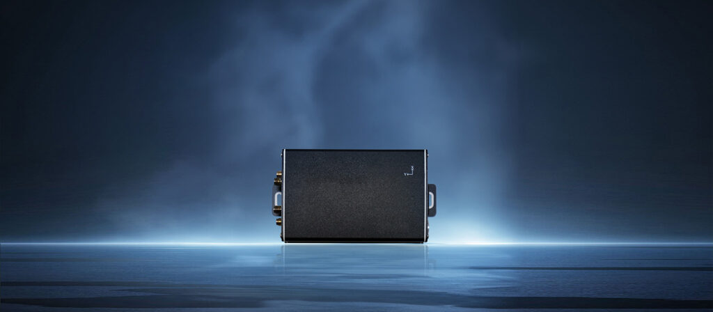
[Introduction] A seemingly simple navigation box is the core technology behind machinery automation. Without purchasing new equipment, retrofitting traditional agricultural machinery with this system unlocks fully autonomous, multi-scenario operations. Here is a closer look at the capabilities of the NAV-L3 High-Precision MEMS Positioning and Attitude Sensing System.
01 | Upgrading Existing Machinery into Autonomous Equipment without High Replacement Costs
Many farm owners and engineering project managers face the same dilemma: their existing machinery is still functional, but upgrading to automation and driverless operations usually requires purchasing entirely new, expensive fleets.
Suzhou Xinzuobiao Intelligent Equipment Co., Ltd. offers a practical solution: retrofit instead of replacement.
By simply installing the NAV-L3 navigation controller onto existing machinery, traditional mowers, seeders, and land-clearing tractors instantly gain autonomous driving capabilities. It acts as a smart brain utilizing the BeiDou Navigation Satellite System (BDS), high-precision RTK positioning (up to 2cm accuracy), and MEMS attitude sensing, allowing legacy equipment to determine its exact location, heading, and optimal route.
This low-cost intelligent upgrade delivers a practical way to reduce costs and increase efficiency.
02 | Five Real-World Applications: One Solution for Multiple Scenarios
The NAV-L3 has proven its capabilities in challenging real-world operating environments. Below are some practical use cases:
- 🌿 Lawn Mowers: Autonomous Operation + Auto-Recharging
For parks, sports fields, and municipal green belts, mowers equipped with the NAV-L3 can autonomously navigate along pre-planned paths. The mower can transition between target areas and automatically return to its charging station when the battery is low, requiring minimal supervision. - 🌾 Seeders: Route Planning and Even Seeding
Traditional seeding relies heavily on operator experience, which can lead to uneven spacing and seed waste. With the NAV-L3’s 2cm RTK positioning and 0.2° heading accuracy, the seeder maintains straight, highly precise lines, resulting in uniform row spacing. This even distribution leads to consistent crop emergence, simplifying subsequent management and harvesting. - 💧 Water Conservancy Slope Protection: Autonomous Operation on Steep Slopes
Working on the steep slopes of major water conservancy projects (such as slope protection along the South-to-North Water Diversion route) is highly hazardous for manual labor. The NAV-L3 uses its built-in MEMS gyroscope to sense the vehicle’s attitude in real-time, combined with BeiDou positioning, allowing equipment to traverse steep slopes safely and work precisely along the edges—removing operators from hazardous environments. - 🌱 Large-Scale Turf Farms: Intelligent Coverage with Zero Overlaps or Misses
For expansive turf farms spanning thousands of acres, the main challenges are missed spots and redundant mowing—the former impacts turf quality, while the latter wastes fuel and time. The NAV-L3 utilizes a backend path-planning system to partition the area into a grid, assigning optimal paths to ensure every section is covered efficiently without repetitive passes. - 🌿 Land Reclamation: Terrain Adaptation and Obstacle Avoidance
Reclaiming wasteland involves navigating irregular terrain with potholes, rocks, and tree stumps. By integrating BeiDou satellite positioning with MEMS inertial navigation, the NAV-L3 maintains stable attitude awareness even in valleys or areas with obstructed satellite signals. It automatically navigates around obstacles to prevent stalling or tipping.
03 | Key Advantages of the NAV-L3
- 🎯 High Precision: Integrating multi-constellation, multi-frequency BeiDou positioning and RTK, the system achieves 2cm positioning accuracy and 0.2° heading accuracy. This performance level makes it highly capable for most precision farming and construction scenarios.
- 📶 Reliable Connectivity: With built-in 4G communication, device data is transmitted back to the control system in real-time. Additionally, it supports the USB RNDIS protocol—allowing it to act as a 4G network card when plugged into a PC, enabling Linux/Windows industrial computers to access the internet instantly. This facilitates remote monitoring even in remote fields.
- 📱 Simple Configuration: Users can connect directly to the device’s hotspot via a mobile app to complete parameter configuration in minutes. There is no need to bring laptops or complex wiring into the field; setup can be done directly from a smartphone.
About Suzhou Xinzuobiao Intelligent Equipment Co., Ltd.
Xinzuobiao Intelligence focuses on the development of high-precision navigation control systems. Centered around our NAV series navigation modules, we provide customers with comprehensive technical support ranging from low-level drivers to upper-level applications. Our goal is to equip every agricultural machine with precise navigation capabilities, ensuring highly accurate and efficient operations.